
2022-04-14T23:15:00Z New editing day has started, actually its a new editing YEAR since last edits were from 2021 ![]()
Just finished reading this dev diary, spotted few oddities but nothing major. Supposedly this terrain is ready for release but needs an thorough arma3 in-game review.
Before launching arma3 had to create arma3_pmc_real_world_data_testing_africa.bat start file for african terrains, which we currenly have only one (as explained in beginning of this dev diary).
Check in arma3 shows that terrain builder mapframe properties surface mask resolution needs to be 1024 x 1024 pixels as now its less than that (512 I believe). And roads.shp is broken, but that was already known in my real world data terrain tool pipeline 00.txt file.
First updated mod.cpp it was easy task, new google/maps and homepage link.
Was not really planning to get into heavy editing anymore, but decided to global mapper export satellite texture and see if I could GIMP paint the forest vegetation areas and convert that to shapes which could be then used in terrain processor.
Its kind of unecessary waste of time right now, release should be in my mind not tweaking some object count, but lets try GIMP painting out and document how it works, interesting to see what comes out of it.
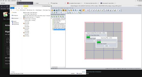
Global mapper pushing data out.
Opened sat_A1.png in GIMP, created new layer called Trees, selected RGB 255,0,0 color just to make it distinctive from the background, then used F free hand selection tool and started to select forest vegetation areas.
Well that was painful, there are so many green vegetation areas and this is just ONE of the 4 x 4 grid tile images.
I did few selections, making the selection is easy but there are so many of them as just said above.
Then I tried fuzzy selection tool with 15 threshold. Using SHIFT-LMB which is add to selection worked pretty well, one click did not select all colors in the image but just the mouse click neighborhood.
However this still was quite the task to wield mouse all around the image selecting these areas, then selections usually were quite splattered with small few pixel holes etc.
I fixed the splattered broken selections by doing grow 10 and shrink 10, this removed all the small holes in the selection and made it much more round and smooth. Pretty nice.
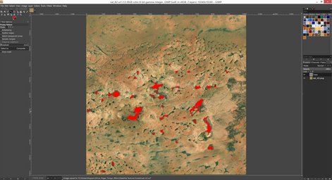
This definitely is not any click of a button quick task and again I must emphasize this is only 4 x 4 grid tiles vegetation in fairly dry part of the world, cant imagine what kind of task would it be in huge green terrain with 8 x 8 grid tile setup.
2022-04-15T00:26:00Z Got sat_A1 through sat_A4 done now, still three more sets to do, its... doable.
2022-04-15T00:58:00Z All 4 x 4 grid tiles done. That wasn't so bad, but yeah remains to be seen if this would become a regular tool pipeline thing, I have my doubts on those green terrains, selecting forests next to a green fields etc might not be that easy.
Then tried to use ImageMagick to convert GIMP XCF images to PNG, well... it worked, kinda, it saved -0.png and -1.png file name images because it knows how to read layers and I didn't provide that parameter info, oh well gets the job done now. Edit: apparently the parameter is simply the XCF layer number at end of the image name like this: "FileName.XCF[1]", which is very interesting parameter indeed, havent tried it out but thats what I found when searching.
I have used imagemagick XCF to PNG conversion one time before and remember how darn slow it is, I mean it really takes forever to convert one 10240 resolution XCF/PNG image. My best guess is that the PNG part is taking so long in it.
Feeling a bit frustrated as this vegetation task as a whole takes this long, I should have not started this, would probably have release package already done heh.
Then created map catalog from these sat_??.png images in global mapper, then did the layer -> create something-something ![]()
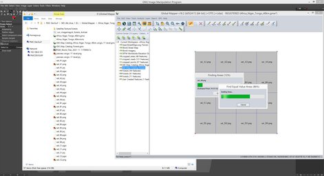
And this is how our forest vegetation shape areas layer looks like.
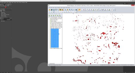
Then exported the forest shapes, unloaded current project, loaded forests shape, it did not require UTM 31N projection converting because this terrain already is 31N, but I had to do the usual terrain builder 200,000/0 coordinate transformation.
Copied one of the terrain processor TPP files to "obj_forest.tpp" and started to tweak it a bit. Changed relative roads.shp path to the current dir (no path basically), copied the two bat files for roads.* copying and *.LBT deleting in terrain processor dir, edited and ran roads bat.
While terrain processor was running, I imported roads.shp to terrain builder...
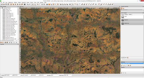
... and exported right back out again.
Terrain processor generated 497,364 objects to this shape, it took quite a while so that means the shape has many unnecessary ... err details. Detailed shapes take forever to generate objects to.
Imported new obj_forest.lbt into terrain builder.
Had tool pipeline task to smooth roads, hmm okay, got that done as well and imported smoothed roads heightmap into terrain builder. Rebuilt terrain, removed the new heightmap layer, exported WRP, saved project and exited, we are done.
Then moveObject re-pathed the WRP file and started pboProject binarization process.
2022-04-15T02:19:00Z Finished binarizing, time to check it out in arma3.
It looked very nice forest shape wise, of course objects are those greece agios efstratios looking trees, but oh well like said we don't have authentic african vegetation objects.
Alright time to start release procedure ![]()
Except going to cook food and eat before starting.
2022-04-15T04:20:00Z Cooking food and eating break is over, back to editing african terrain. Okay, lets get that release procedure going, these terrains wont release themselves ![]()
Added pmc_africa_niger_tongo class name to PMC "worldSize" mission pack compile bat file terrain list, this gives us bunch of missions to play with.
Generated bisign keys for the addon pbo's using 1._run_sign_generic.bat file, then edited 2._run_pack_latest_release.bat and the readme text files. Then ran the bat to 7-zip pack the release package.
2022-04-15T04:47:00Z Screenshots taken, sorted, edited and converted.
2022-04-15T05:31:00Z All other web pages were created in localhost, now need to move this dev diary text there too (from regular text file) and start proof reading and link adding.
Uuh took a while again to proof read while adding those links in, my copy-paste finger is hurting so bad again hehe. Man I'm telling ya, editing terrains is easy, making this diary shit is HARD ![]()
But now almost everything is done, only thing left to do is the news/forum post template and then pressing the evil big red button for the release.
2022-04-15T06:36:00Z PMC Africa Niger Tongo v0.1 has been released! ![]()
Continue reading page 5, previous page 3 or back to Dev Diary PMC Africa Niger Tongo root page.
PMC Africa Niger Tongo: Changelog, Dev Diary, Screenshots. Back to PMC Terrain's page.