40 kilometer x 40 kilometer terrain with high resolution satellite texture. View at google/maps
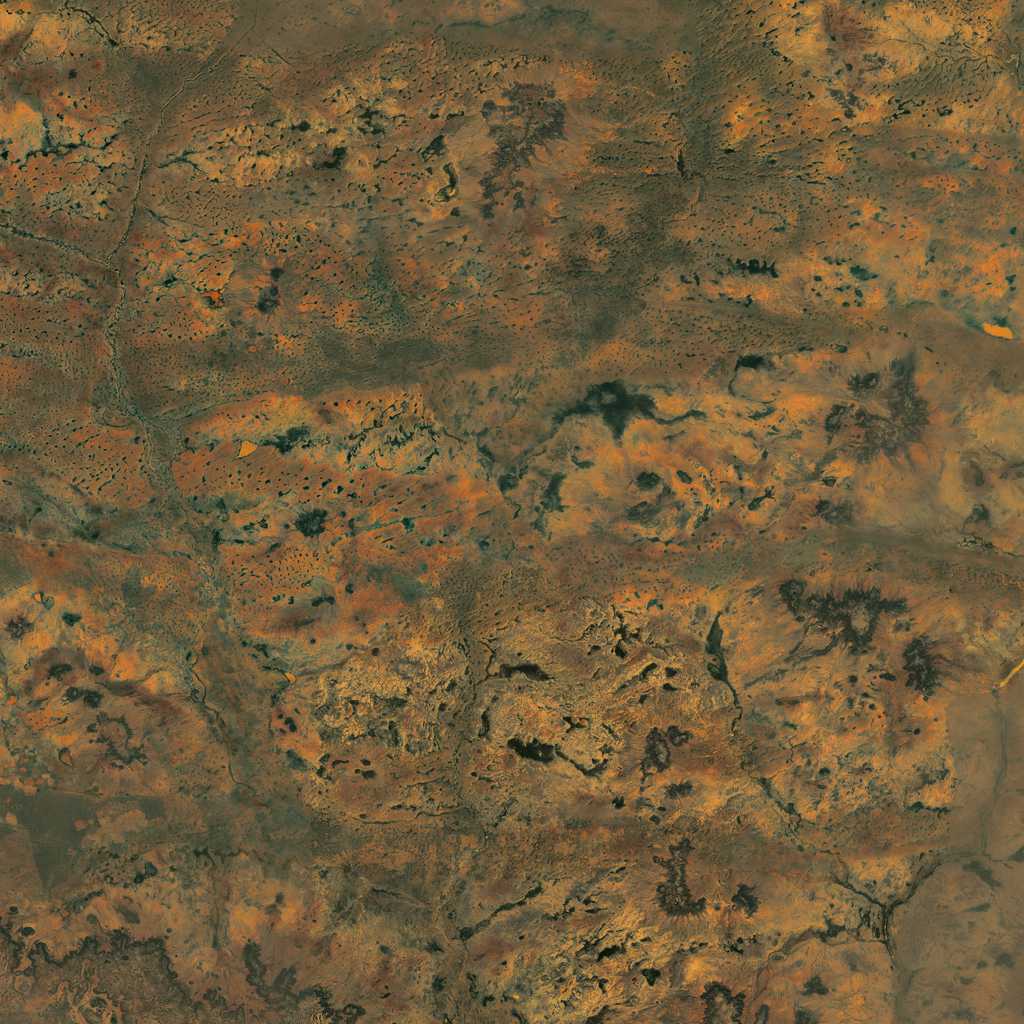
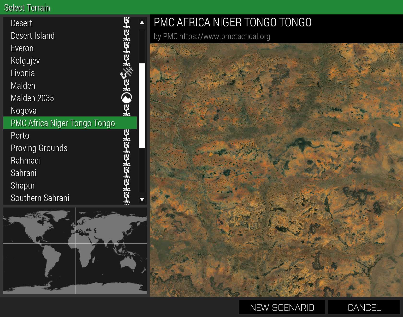
PMC Africa Niger Tongo is a medium size realistic real world data terrain. See more Tongo Screenshots.
Heightmap source is SRTM 1-arc-second SRTM Plus v3 30m detail resolution. Satellite texture source is ArcGIS world imagery, 1 meter / pixel scale which is very high detail. Satellite mask is generated from OpenStreetMap (OSM) landuse and natural areas data. Roads are created from OSM data. You can learn more about how to create ArmA 3 Terrains from PMC Editing Wiki: ArmA 3 Terrain Tutorials.
PMC Africa Niger Tongo ArmA 3 terrain is work in progress (WIP), for example object editing has not been completed. If you find bugs or issues you would like to report, please contact us.
"How big map is 40 kilometers?" ArmA 3 default Stratis is 8.1 kilometers (eight point one), Altis is 30.7 kilometers, Tanoa is 15.3 kilometers and Livonia is 12.8 kilometers, so 40km is only 10km bigger than the largest bis terrain. PMC wont be making any smaller than 40km size terrains, unless its some special case like osama bin ladens compound or some small island where creating a huge empty ocean around it makes no sense.
PMC terrains are released with bisign keys for a proper dedicated server multiplayer use.
This terrain was created because of October 4th 2017 US Special Forces fire fight called "Tongo Tongo ambush" (wikipedia) where four American and Nigerian soldiers lost their lives. Special note: the linked wikipedia article is safe, but the VIDEO in wikipedia is extremely graphic, if you do not want to see such content do not click the VIDEO link IN wikipedia.
Tongo Tongo ambush location, roads and forest vegetation are accurately placed in PMC Africa Niger Tongo terrain.
Please note that ArmA 3 does not have authentic african bushes and trees vegetation objects, our terrain uses a3\ objects which are familiar from greece terrains.
Heightmap grid size: 4096 x 4096
Cell size: 10m
Satellite texture / mask resolution: 40,960 x 40,960 pixels
Satellite surface mask size: 512 x 512 pixels
Texture layer size: 40m x 40m
Objects count: 497,364
All the newest edits, bug fixes, additions etc can be read from changelog PMC Africa Niger Tongo.
Very comprehensive details, thoughts, plans, pains, failures and successes are painstakingly documented often times with screenshots into Dev Diary PMC Africa Niger Tongo.
Please note that these are NOT tutorials, if you want to learn how to edit ofp/arma addons, please check PMC Editing Wiki.
PMC provides all our terrain addons with a mission pack. Some terrains also include campaign(s). Get campaigns from PMC ArmA 3 Campaigns page.
Required Addons: PMC Terrain Data and CUP Terrains Core and Maps.
PMC Africa Niger Tongo: Changelog, Dev Diary, Screenshots. Back to PMC Terrain's page.