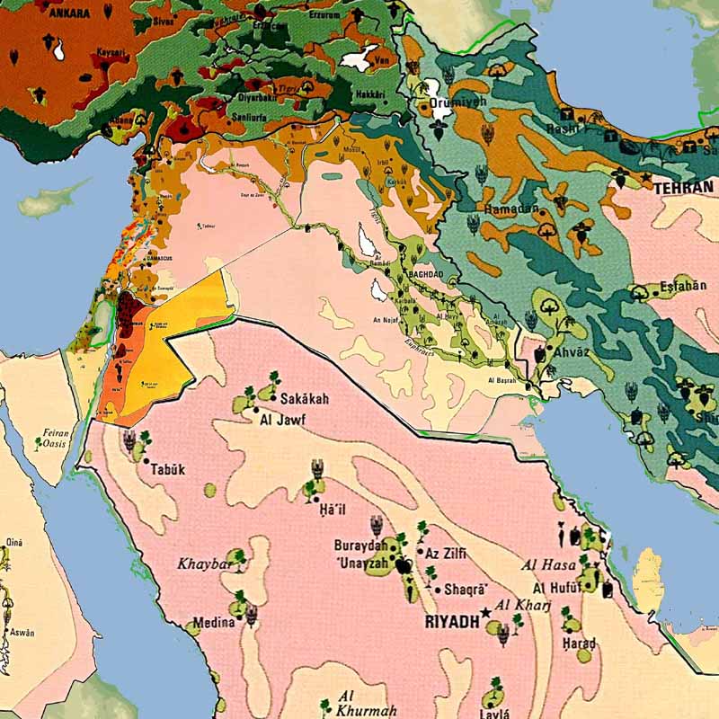
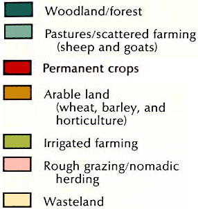
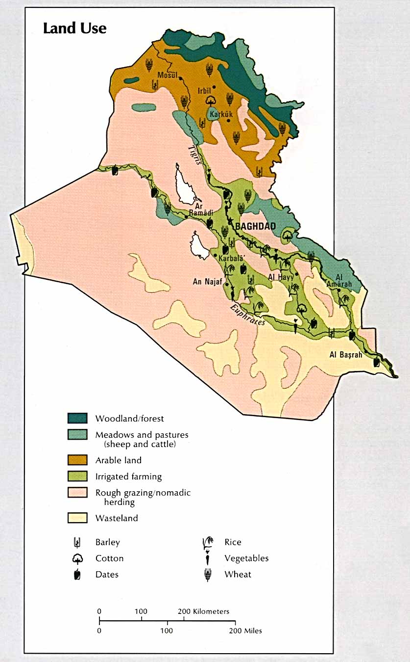
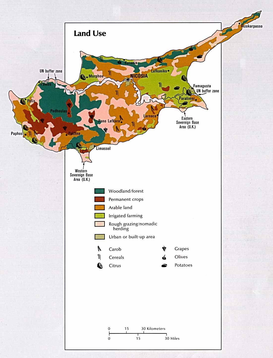
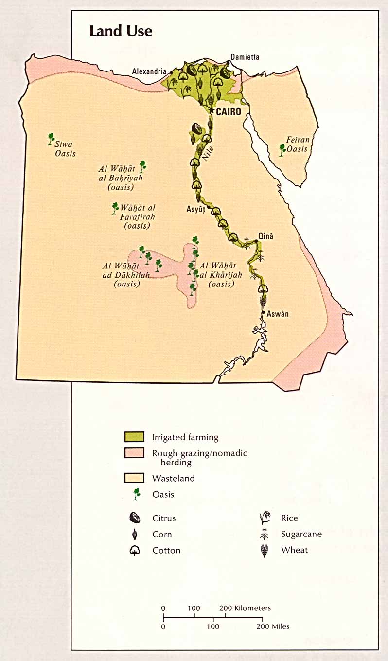
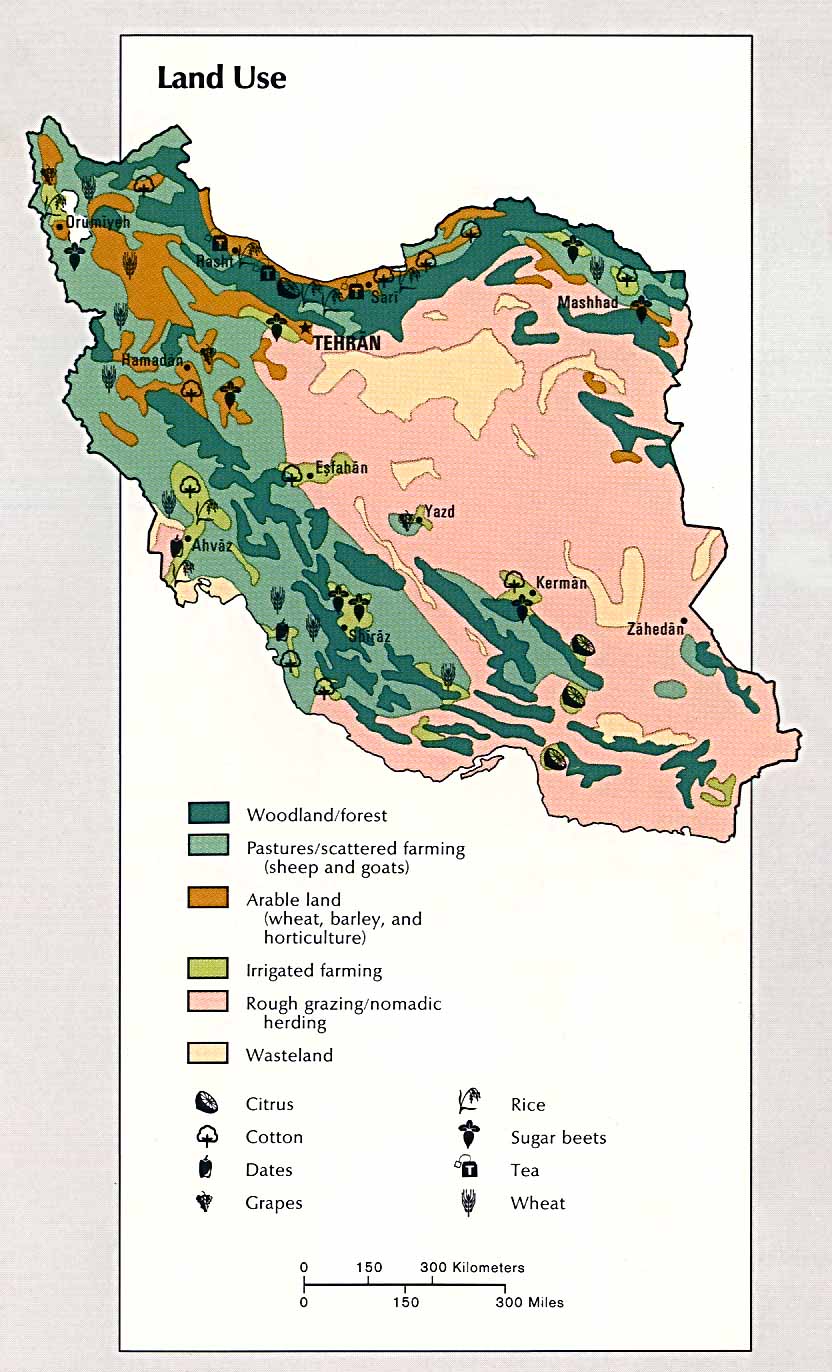
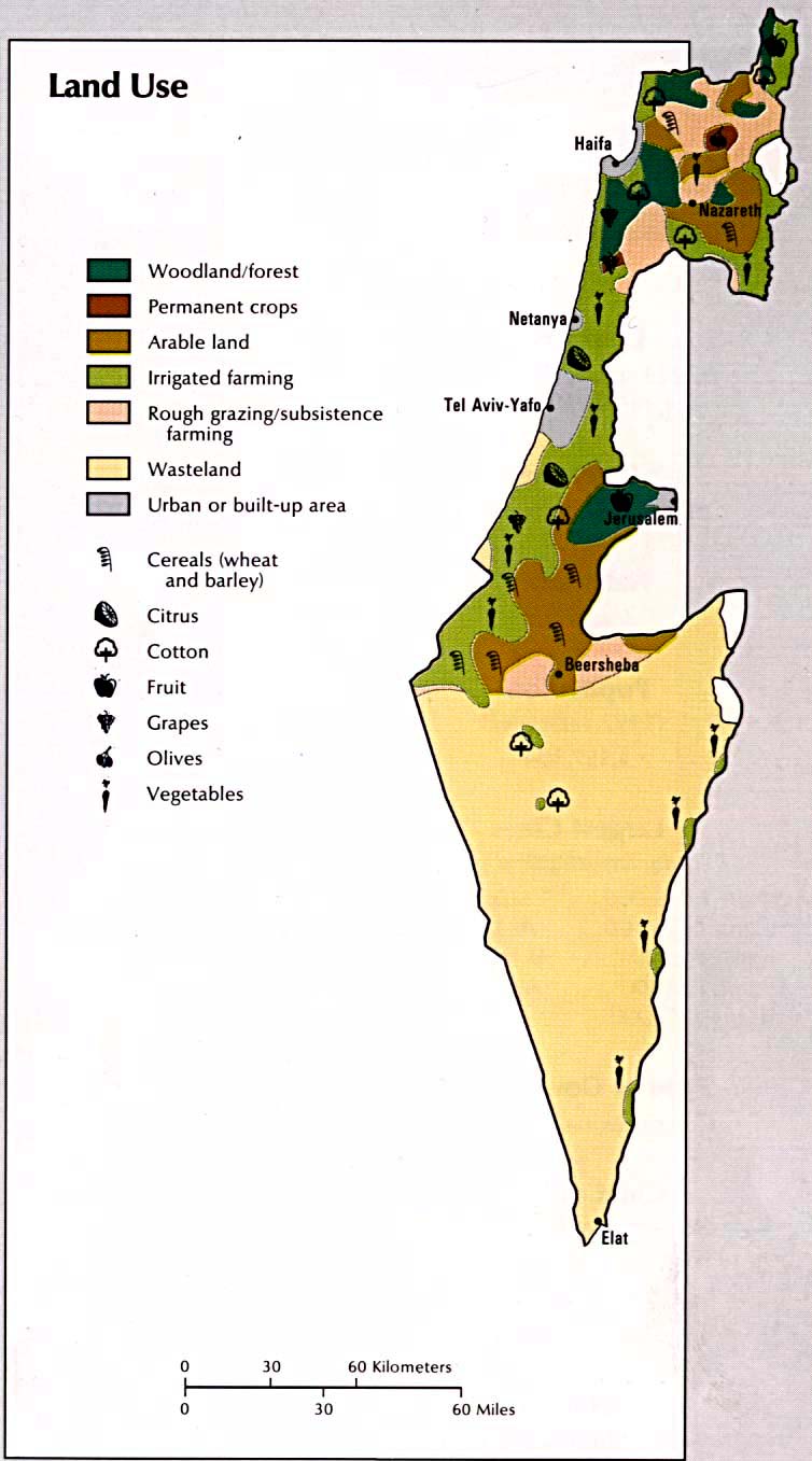
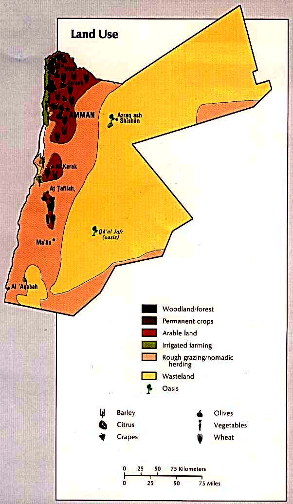
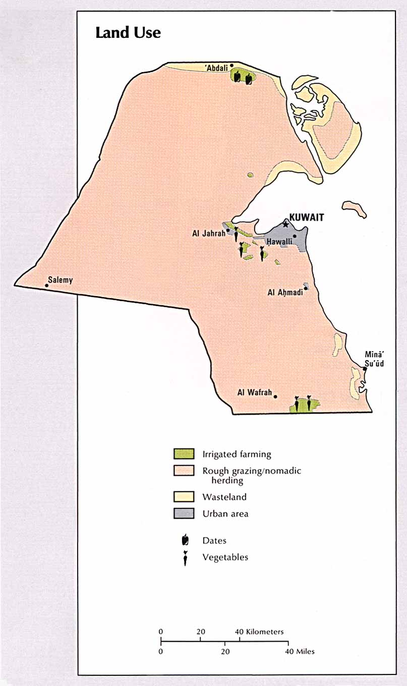
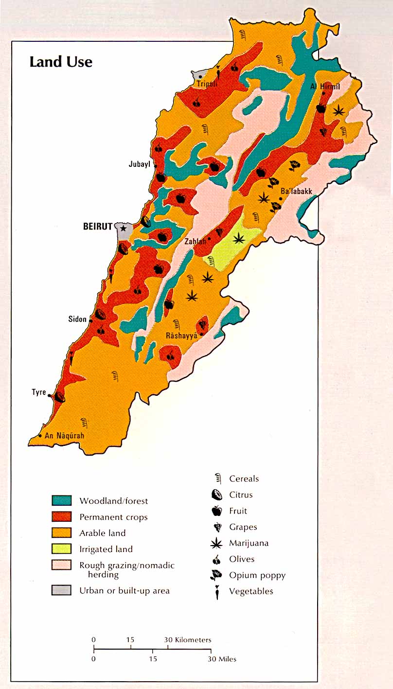
This is perfect image of what I'm looking for:
http://www.lib.utexas.edu/maps/atlas_mi ... q_land.jpg
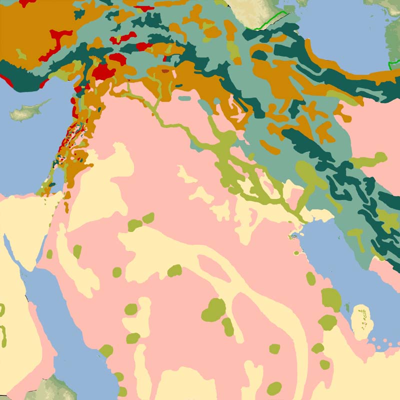
Here is two example images, iraq/saudi:
http://isu2.cedare.org.eg/gis/images/irqmap1.jpg
http://isu2.cedare.org.eg/gis/images/suamap1.jpg
But those are too low res images as we can't make out the text
If you have ever wanted to help build theaters, this is one department... research. Any and all links/images/info is very welcome for terrain types or land use, what ever its called.
PMC TFW
Snake Man