2022-04-06T14:00:00Z New editing day has started, actually editing YEAR ![]()
Just minutes ago I released PMC Ukraine Berdyansk terrain and now continued following my 00.txt real world data terrain tool pipeline text file to the next terrain in line, and that is taiwan penghu. Finished reading the above dev diary text which is awfully lacking, guess during this terrains development I wasn't exactly in a chatty mood eh ![]()
Okay lets try to correct that now. So today my breakfast was ... haha no! just joking, wont be posting picture of my food for you to hit like button to, hehe hell no! ![]()
As usual getting back to a terrain I'm not familiar with (havent done any work in past few months, actually its 5 full months since the last edit) begins by doing arma3 in-game check to see whats-what.
First thing I see is that this terrain needs terrain builder mapframe properties surface mask pixel resolution increased, its now most likely 512 or maybe 1024, it needs to be brough up to 2048 to remove the "mosaic" bug in 2D mapview.
Also saw what my 00.txt tool pipeline text list already told me, roads.shp is broken and needs to be terrain builder import/export shuffled.
What was extremely disappointing is the coastline, it is raw, a VERY raw. I didn't mention it much on this dev diary but its the GEBCO data which makes elevations above water in the coastline. In GIMP the coastline is accurately painted to satellite texture but heightmap.asc is very poor.
I can now fix this not exactly easily in global mapper but its doable with my brand new tool pipeline for coastlines which I've already used in anger for two times before, this will be a third terrain to have it.
Airfield runways poly line and config.cpp class names{} are missing. Airfield runway heightmap.asc has not been smoothed out.
2022-04-06T14:51:00Z Updated mod.cpp for google/maps and homepage links and accurate terrain specs.
In terrain builder inspected whats there, well there is some odd obj_forest which apparently I created myself, umm why heh. If OSM forests are lacking then new forest area shapes need to be painted in GIMP and turned into actual shape files in global mapper. Terrain builder is fine as its fast and "snappy" to use with poly lines and shapes, but its still much more painful work than in GIMP, especially if you have to edit those shapes later, GIMP is the way to go.
Created airfield 1 Keypoints.
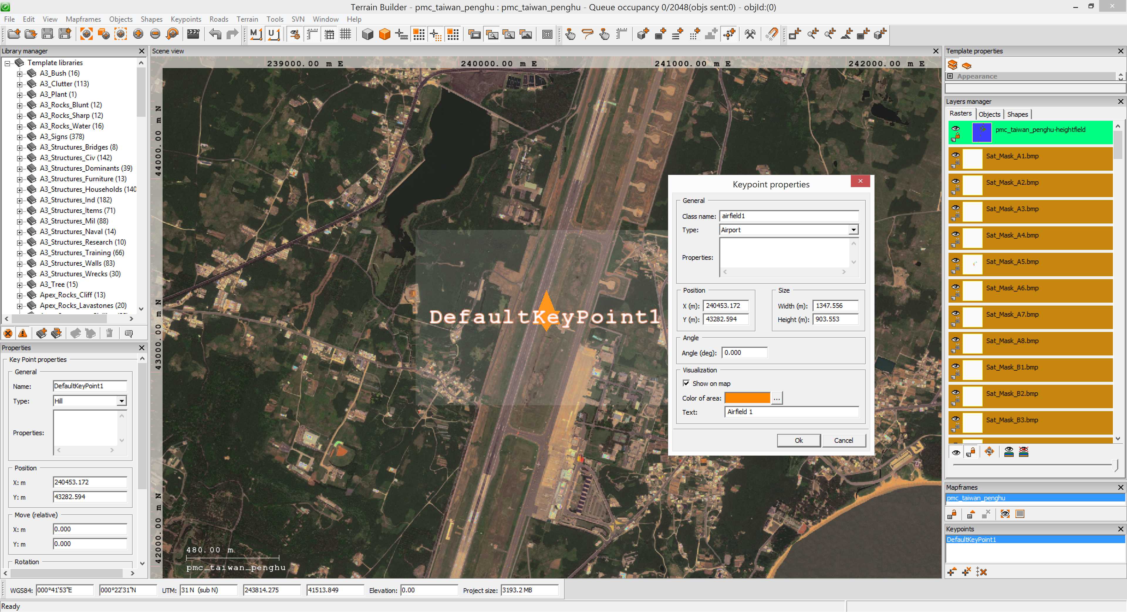
Then created 3 more keypoints to cover all the airfields. Exported WRP to get the .HPP file which was copied over to pmc_names.hpp config file.
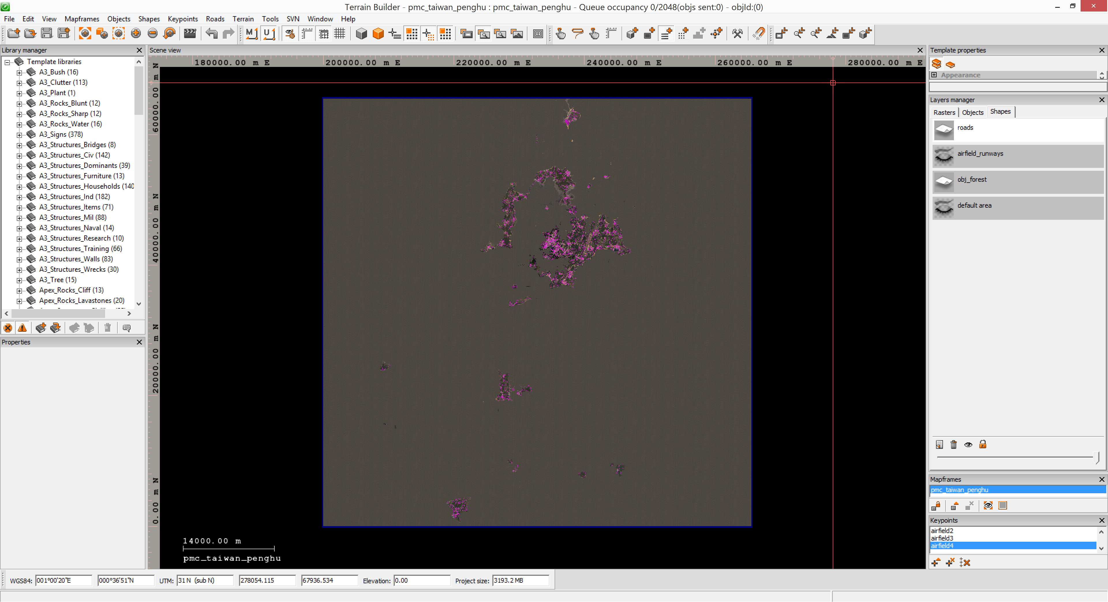
Next created shapes layer airfield_runways and the four airfield runway poly lines, exported the airfield_runways.shp file into pmc_taiwan_penghu_data\roads\ directory.
Used global mapper to load airfield_runways.shp, added ID 7 and ORDER 0 err feature values to them. Then loaded roads.shp into the same project and exported now merged airfield_runways and roads into roads.shp shape file. Then terrain builder imported roads.shp and exported it right back out again which will fix arma3 no being able to read the roads.shp file.
Fun fun fun shuffle (not).
Checked tool pipeline for latitude/longitude config but it was already done, probably was so horny to edit forgot to check this tickbox heh.
2022-04-06T15:20:00Z Next need to start working on the ocean coastline heightmap fixing, I really do not want to do this its so cumbersome and painful, but lets see what can be achieved.
Went to global mapper Taiwan_Penghu_65km/ dir and there was nothing, ugh. So used global mapper to export satellite mask in 8 x 8 grid tiles. Yeah eight by eight is way too much for 65km terrain, four by four would have been fine, but anyways that is the way it was done initially so I have to go along. Also I have already painted the GIMP mask tiles so unless I want to do the same job all over again, these grid tiles will remain forever 8 x 8, heh ouch.
Had to use GIMP to open all the Satellite.Mask/ XCF images, merge into Sat_Mask_??.png images and save, this was painful manual labor. Hmm I wonder if I could setup ImageMagick to only merge the ocean RGB colors, hmm.
2022-04-06T16:06:00Z Finished GIMP merging Satellite.Mask/ XCF images to Sat_Mask_??.png images, uuh.
Jumped ahead quite a bit here, got the work done in global mapper and final heightmap.asc was saved with no water creeping to land, accurate coastline and flat out -3m depth elevation oceans. Did the L3DT airfield runway smoothing for all four airfields (actually most of them are more like airstrips) and finally ran terrain processor road smoothing task.
2022-04-06T18:11:00Z Terrain binarized, ready for in-game testing. I'm off to a lunch break...
Checked it out in arma3, ocean depths are OK now with -3m, some of the coastline is not exactly accurate dunno why, mostly its fine though. The southern most airfield is not smoothed out, maybe I missed it. Also need to fix that -3m heightmap elevation on terrain edges as in E, S and W edges it just doesn't look good but in N edge it actually turns into land, dunno why but its probably 1 meter elevations in there, weird.
Heightmap can be fairly easily fixed in L3DT although I would like to get more permanent solution that fixing it every time you get a new heightmap, although why would you need new ones, but just saying.
Hmm inspected heightmap in terrain builder, this is the north edge.
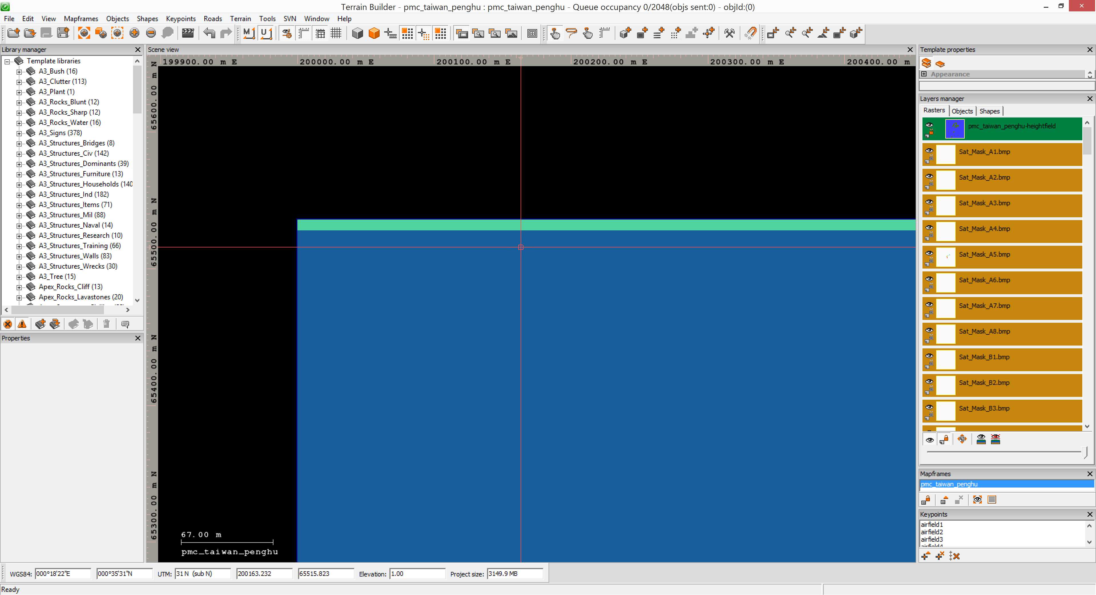
The green top most line is 0 meter elevation, where cursor crosshairs is located is as you can see 1 meter elevation, don't ask me why they are switch that way, 1m should be green and 0m should be blue. More to south from that crosshair position is the normal ocean -3m depth. Hmm really odd, wonder where that top most 0/1m elevation line is coming from.
With L3DT opened the existing project I saved, smoothed out the southern airfield runway, then in 3d sapphire took a bulky big brush with lower-to -50m value and went through all the terrain edges to paint them into -50m depth. Ugly, but well at least not so ugly as it was before.
Binarized and checked in-game, well the edges now look like I expected them to. There is the gridded -50.0m elevation look, that was my bad, should have put it to -49.99m or -50.01m etc but oh well, you cant see the edge depth in 2D mapview before you really zoom in. On 3D it doesn't look natural, but at least it removes infinite terrain issue where lower elevation depth is repeated to oblivion making really bad look, now its just deep dark blue ocean.
The southern most island airstrip is scary, it begins and ends on the islands shores heh, if you overshoot your landing you will take a dip in the ocean ![]()
Its also curved, dunno if this is just some SRTM heightmap issue or is it really like that in real life, but yeah overall quite scary looking airstrip, makes me think that these guys really wanted aircraft access on that island as they made such dangerous airstrip heh.
Anyways, -3m ocean depths, coastline is fairly accurate but there are some clunky parts, airfields runways smoothed and class names{} done. Overall its looking alright.
Object situation is, quite bad. The OSM coverage is only two small forest patches, even though there is plenty of more forest areas in the satellite imagery. I'm really not a fan of this forest setup right now, but it will have to do for the first release.
2022-04-06T20:02:00Z Going through my tool pipeline text and bugs/issues report list, hmm nothing pending right now... its time to start release procedures ![]()
Added pmc_taiwan_penghu class name to PMC "worldSize" mission pack compilation bat file terrain list, gotta have them missions for out terrains too.
Got screenshots taken, a bit different approach here as there are no big forests to showcase. Got them sorted, edited and converted. Then created the web page php files and setup screenshots and changelog.
2022-04-06T21:11:00Z Moved this dev diary text from localhost to the actual web page and started proof read, add links etc.
2022-04-06T21:39:00Z Finished proof reading, verifying images and adding links. Everything looks good here.
2022-04-06T23:37:00Z PMC Taiwan Penghu v0.1 has been released! ![]()
Read previous page 2 or back to Dev Diary PMC Taiwan Penghu root page.
PMC Taiwan Penghu: Changelog, Dev Diary, Screenshots. Back to PMC Terrain's page.