2021-10-09T21:24:00Z New editing day has started. This day scares me, I'm planning on editing two or more terrains at the same time. Taiwan Kaohsiung has progressed good way already, Taiwan Penghu has only its satellite imagery downloaded so far and who knows what other terrain I get to start before this day is over. Problem with this is to write these dev diary texts, take screenshots and capture video without completely lose focus what-is-what. When terra incognita is downloading satellite imagery or some other long duration process is running it feels so wasted time to just sit there and wait when I could be editing something else on the side, this is why its so great to edit several terrains at once. Now with dev diary writing and video capturing... ugh not sure if I can do it, but I'll give it a try, lets see what happens.
Used irFanview to go through all sat_*.png satellite texture tiles and wrote down full ocean tiles, coastline tiles and tiles with clouds in them. Also wrote this into my tool pipeline as a step, even if you have landlocked terrain you still need to go through tiles to check for clouds.
Terra incognita re-saved oziexplorer images for Taiwan_Kaohsiung_81km_1_arcgis_17_level which fixed the two black tiles on it.
2021-10-09T22:31:00Z In between here created PMC Taiwan Chiayi terrain, started its terra incognita download which is going to take at least 8hrs, so good to have that running in the background while I'm working on PMC Taiwan Kaohsiung terrain ![]()
Multitasking dude, thats how we roll ![]()
I really don't like this dev diary and video recording bunny hopping, but now that terra incognita is doing its thing for 8 whole hours I'm okay.
Next step here was to GIMP edit all the full ocean, coastline and cloud tiles. There were few nasty cloud groups which will be difficult to clone stamp tool brush but gotta do it. First I'll create ocean seed tile and bat file to copy it over to rest of the tiles.
2021-10-09T22:40:00Z Full ocean tiles done and copied, then started to GIMP hand edit those coastlines and clone stamp tool brushing clouds, oh man this will take a while ... ![]()
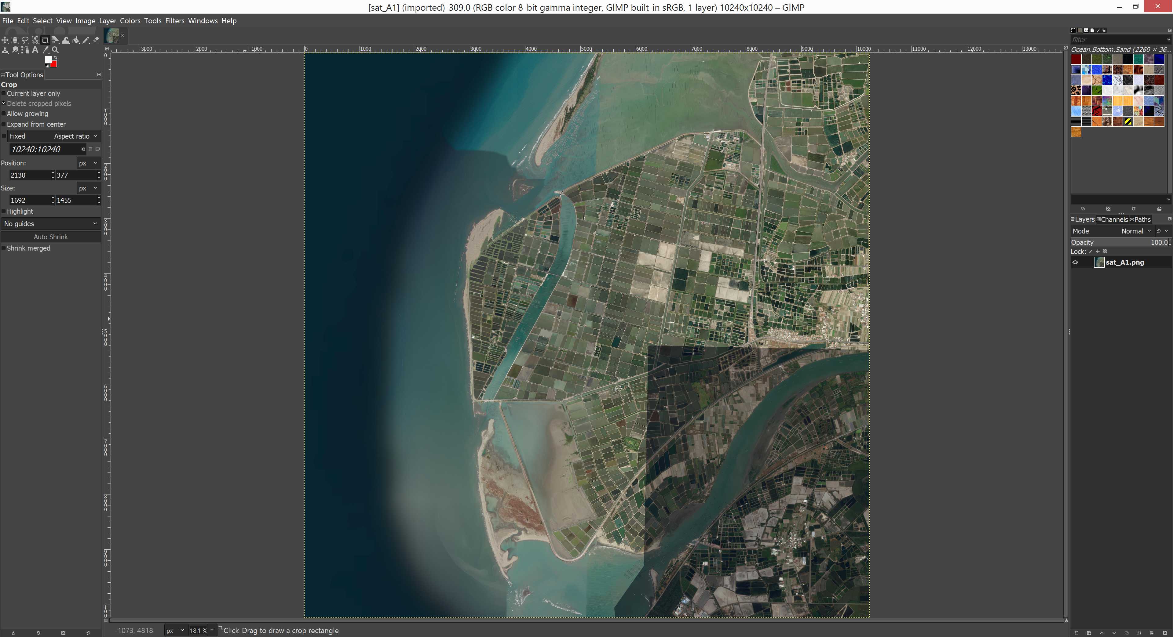
First coastline tile I opened, sat_A1 was just horrible, there was wave breaker / barrier whatever its called, landmass and then another set of ocean water kind of harbor like areas, so making free hand selection for those is going to be total bitch. Decided right away to cheat and skip this painstaking work, I'm just going to create free hand selection to the outer edge of land. Maybe I'll come back to fix it when some boring moment arrives later today, but for now I'm not going to start with such painful task.
Here is the tile open in GIMP, you can see how nasty coastline this is.
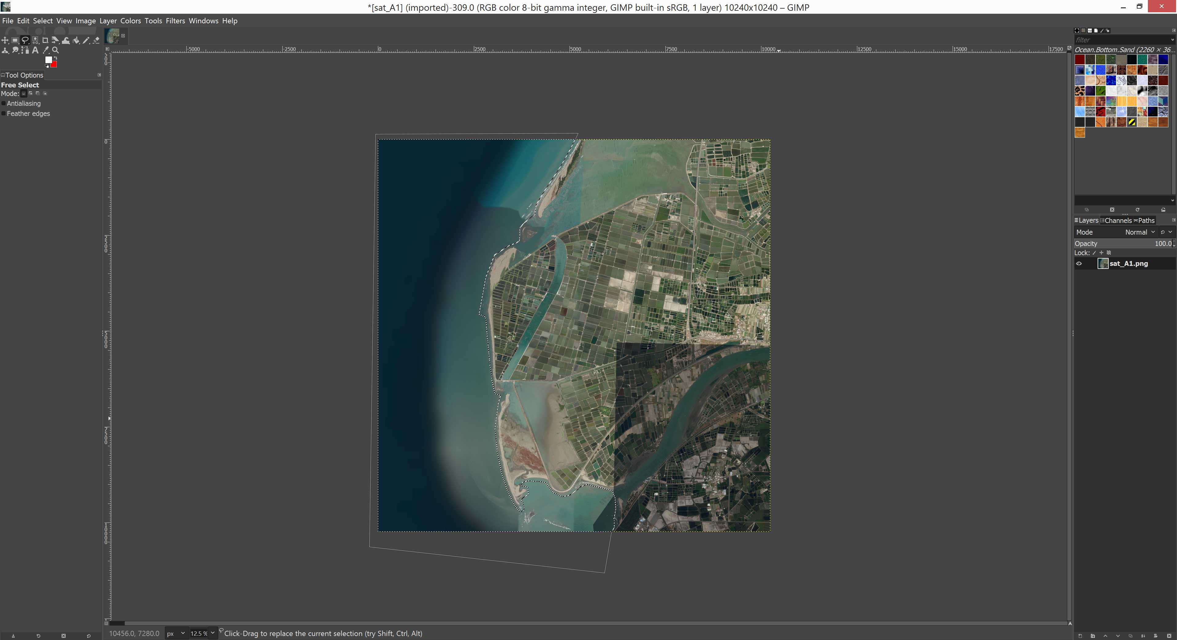
And I quickly did simple selection for it, this is how rough and simple it looks.
Did several of these coastline tiles with low precision free hand selection, didn't feel good about it. Then I ran into some very bizarre harbor situation, there was satellite imagery patch where two different sets of images merge and ... well dunno how to explain it other than to show a screenshot.
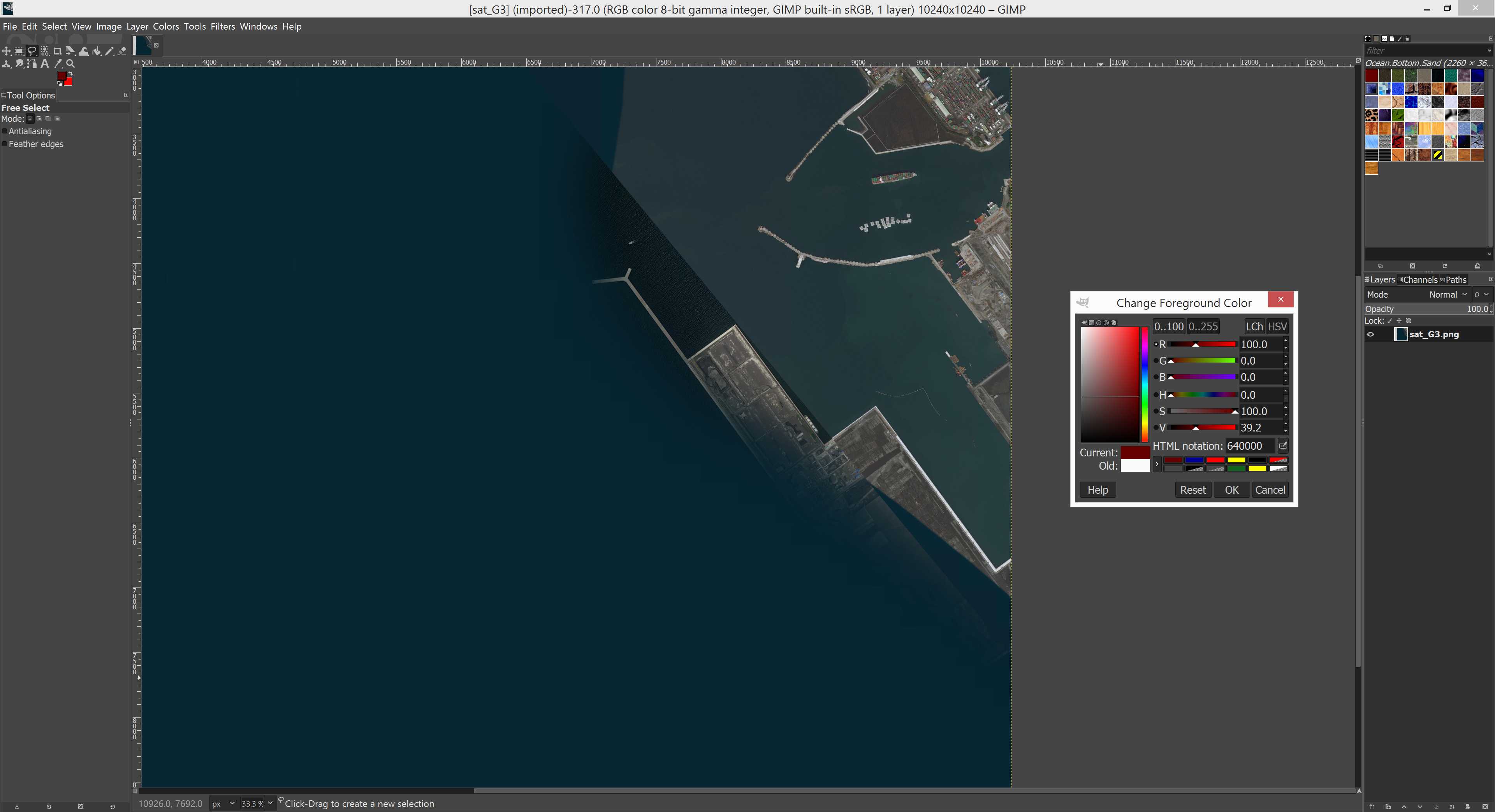
Looks like very unfortunate event with two sets of imagery, no idea how that harbor piece is in real life, need to check this location from google/maps maybe there is an intact image of it.
Right now I just did free hand selection to this image approximating the harbor shape, its the best I can do.
2021-10-09T23:27:00Z Finished simple coastlines. I'm already thinking that because these "simple coastlines" arent instant or automatic, that if I spend ANY time doing coastlines... why not just do them precisely in the first place, if I do simples now just to get stuff in-game and then come back later and do the precise selections ... the whole combined time is WAY more than doing it normally meaning precisely in the first go. Hmm indeed. But.. well, yeah... ![]()
Then was the clouds, ugh, I love overcast cloud cover in real life as they block the Big Satan on the sky, the Sun, but in arma3 satellite images... I hate them, with a passion ![]()
It has been truly painful to clone stamp tool brush these clouds off as I hate do create fake satellite imagery, but what can you do, white puff of cloud looks atrociously bad in-game so anykind of generic terrain mush instead is much better. Not an idean solution but... until you get perfect satellite imagery its what you have to do, you don't have to like it, just get it done ![]()
2021-10-10T00:54:00Z All satellite texture tiles fixed for full ocean, coastline and clouds. Aayeah, uuh! ![]()
Then it was graphicsmagick darkening time. Also in this screenshot you see Taiwan Chiayi satellite being downloaded.
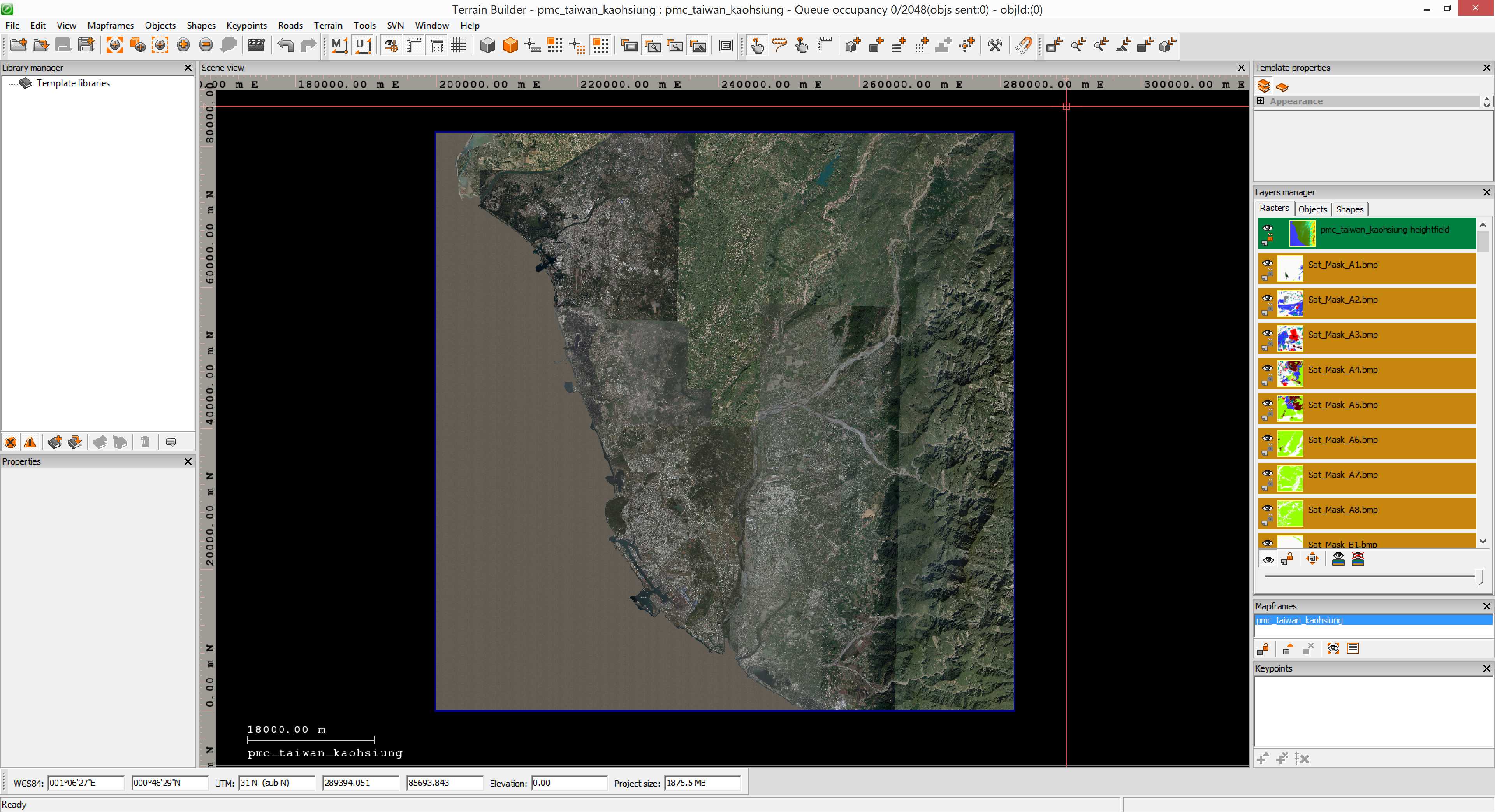
2021-10-10T01:21:00Z Downloaded GEBCO ocean seabed ASCII Grid ASC elevation data, merged it with SRTM elevation data in global mapper and exported new ASCII Grid heightmap.asc file. Then imported this new ASC into terrain builder, looks good. Then started to import satellite mask.
2021-10-10T02:17:00Z Terrain builder finished importing satellite texture and mask.
Then started to generate layers, this will take a while again.
2021-10-10T03:30:00Z Finished generating satellite texture, begun satellite mask generation.
2021-10-10T04:42:00Z Forgot to timestamp earlier, now Convert Layers PNG to PAA Fast bat is almost finished.
2021-10-10T04:56:00Z Now _data_layers\ RVMAT re-pathing with moveObject is running, this terrain project is just about ready for pboProject binarizing. However I am not going to do that next, there is no rush, I just wanted to get all the base files and directories done now. But yeah this project is looking pretty good now, not much BULK work to do anymore.
And yes I used "this project" term because I still havent memorized this terrain name let alone its spelling ![]()
2021-10-10T05:10:00Z RVMAT re-pathing finished.
Continue reading page 3, previous page 1 or back to Dev Diary PMC Taiwan Kaohsiung root page.
PMC Taiwan Kaohsiung: Changelog, Dev Diary, Screenshots. Back to PMC Terrain's page.