2022-03-26T04:42:00Z New editing day has started, after waking up took my time to do computer chores and eat days first meal, now we are getting started with editing. Yesterday just almost minutes before I crashed to bed global mapper finished exporting sat_*.png satellite texture images in 8 x 8 grid tiles.
Started loading satellite texture tiles into GIMP, until I realized that nah why go through everything when I can just check the exact file name from terrain builder.
Got the sat_F4.png painted in ocean seabed bottom texture pattern, saved into XCF on Satellite.Texture/ dir, then copied graphicsmagick and BPW (PGW world file) bat files into the project dir, ran the BPW one and graphicsmagick Darken Merge Picturemap Satellite Texture Tiles.
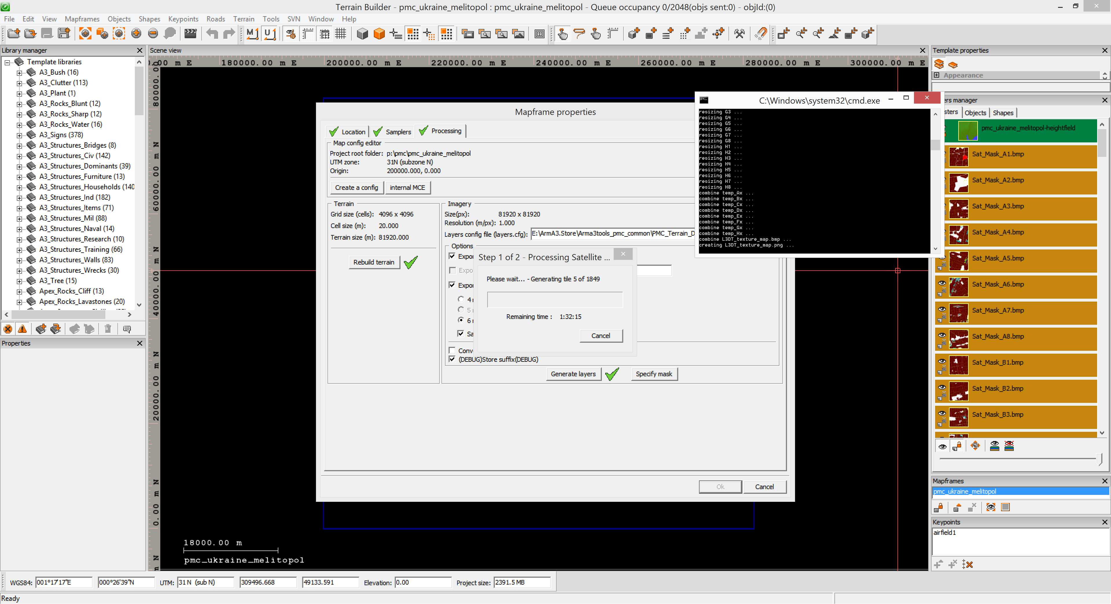
Once done refreshed the Sat_Tex_F4.bmp tile in terrain builder, started L3DT texture map generation graphicsmagic bat and then started terrain builder generate layers.
Uh oh this takes another few hours. So long process to fix such an small issue. Oh well, gotta get it done.
Maybe I'll edit some other terrain or do other computer chores while this process is running.
2022-03-26T07:07:00Z Terrain builder finished generating layers. Then exported WRP.
Then moveObject re-pathed WRP and started Convert Layers PNG to PAA Fast bat to process some layer images.
2022-03-26T07:37:00Z Started pboProject binarization (PMC Editing Wiki: search "binarize"). Hopefully all new edits are in heh.
2022-03-26T08:14:00Z Binarization finished.
On the in-game arma3 test right away realized that forgot to update picturemap_ca.tga (ArmA 3 Terrain User Interface) before binarizing, OK that is a easy and quick fix. Further checking shows that the ocean coastline "fingertip" is not exactly pretty, but guess it will have to do for now.
Also towards west found another river which is flooded in arma3, that has to be fixed, how the satellite texture looks, I'll just set it to 1m elevation (dry ground level) to make it simple. It would be way beyond the scope of this project to start fine tuning every other heightmap grid cell to absolute perfect elevations for such river type location. Just not worth it.
But yeah this means yet another binarization 30-45min or how long it took anyways, oh well the sooner I start the sooner its finished ![]()
Below screenshot shows L3DT heightmap view, the red outline is coastline, kind of difficult to see but "inside" the red line elevations are below 0 meters or so. I need to fix those "pixelated areas" in east and a little bit on the main river coastline east side as well.
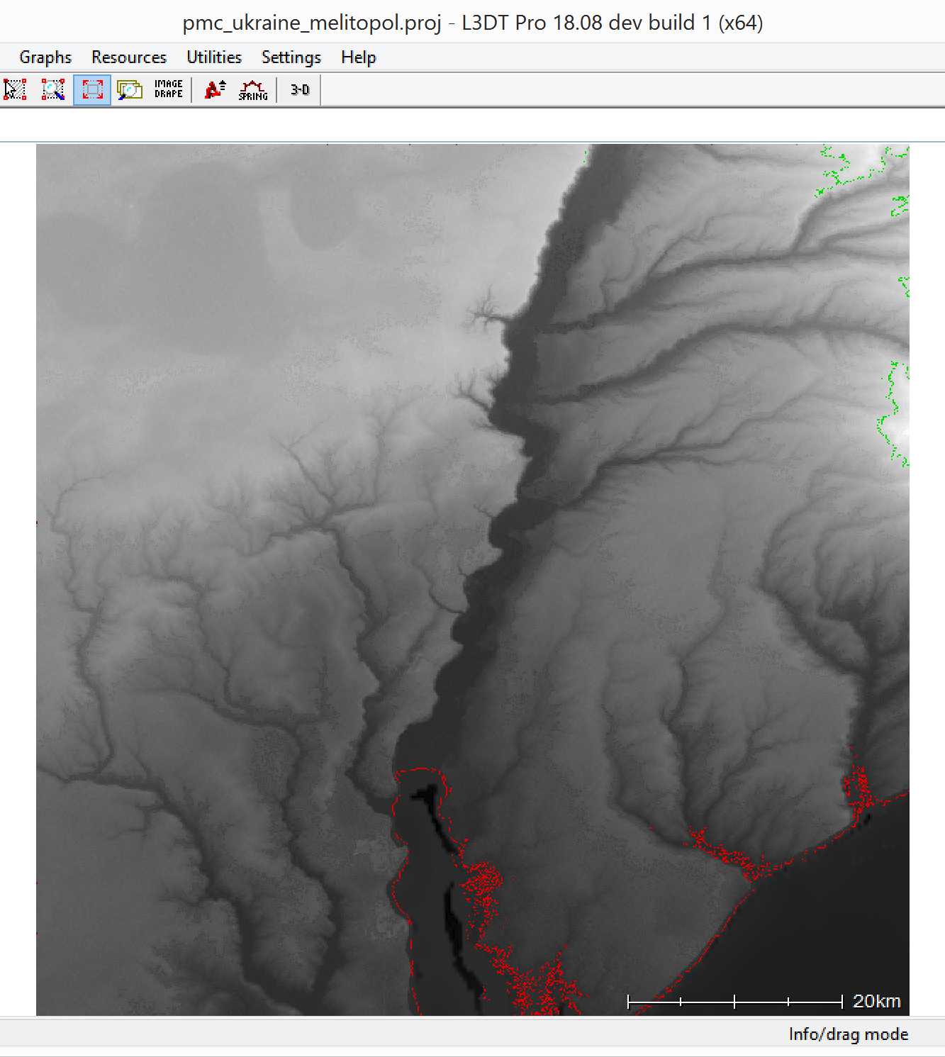
Man do I hate working with L3DT 3D sapphire heightmap texture mode as it doesn't work properly, you have to hammer spam the brush strokes thousand times so it would "stick", just unbearable situation for editing. Why do we have all these shitty tools I don't get it ![]()
Anyways.
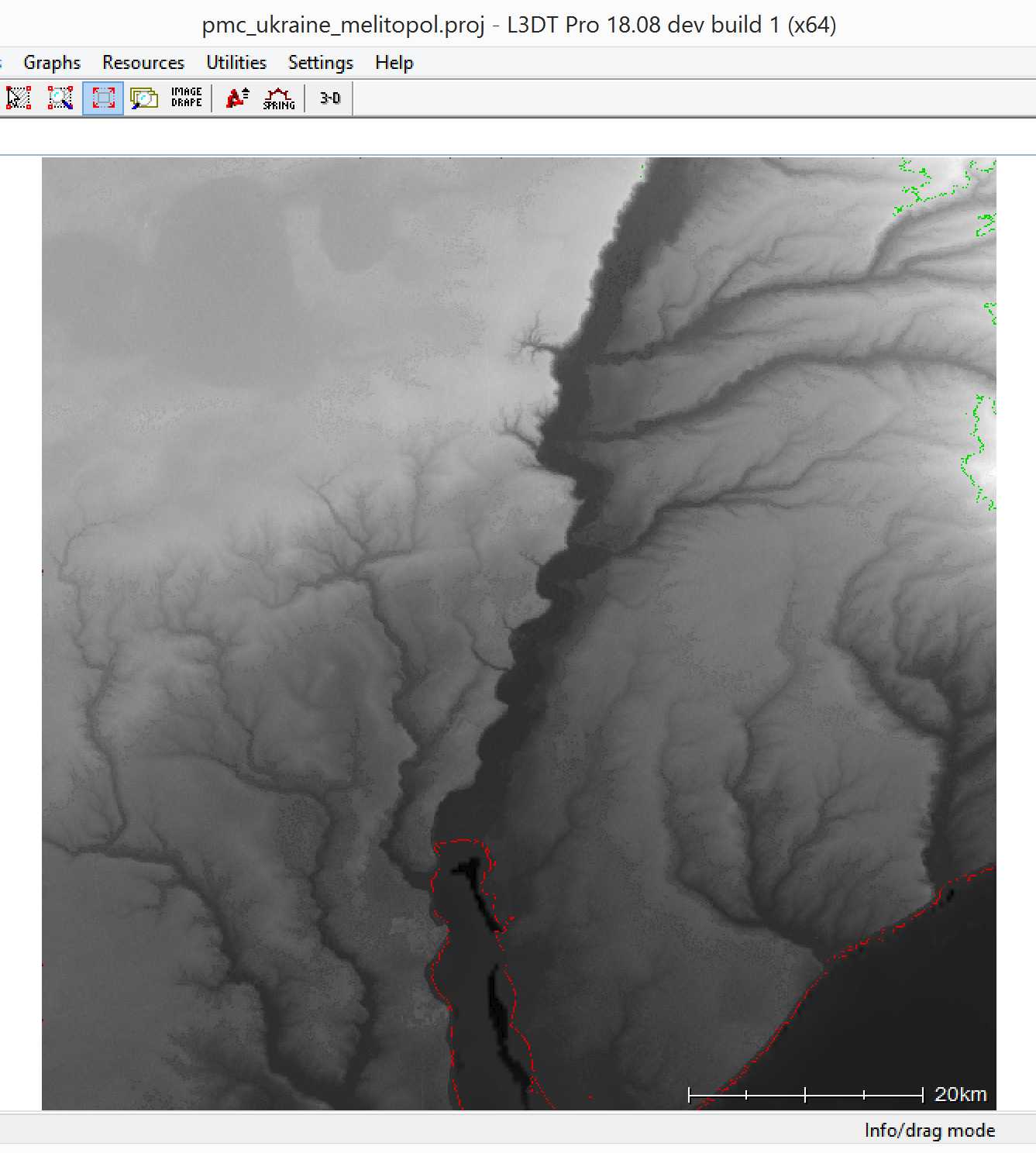
All fixed up:
Started terrain builder, imported new L3DT edited heightmap, then rebuilt terrain, removed the heightmap layer, exported WRP and saved project.
Moved new global mapper exported and graphicsmagick converted images to terrain builder source dir, then moved the picturemap_ca.tga into pmc_ukraine_melitopol_data\ addon dir.
2022-03-26T08:47:00Z Started pboProject binarization, again. Hopefully I'm now binarizing the initial release version ![]()
Oh and its my lunch time, perfect! ![]()
2022-03-26T09:15:00Z Feeding time over, binarize is still chewing its latest meal, I'll wait.
2022-03-26T09:27:00Z Binarization done.
In-game check shows that well yeah, for picturemap_ca image to look nice I have to export the GIMP XCF edited satellite texture tile images into global mapper dir before running graphicsmagick bat which will create picturemap_ca.tga among other images. Right, totally forgot about that one. Hmm wonder if graphicsmagick could read GIMP XCF files, that would speed it up a lot.
At least the heightmap looks good now on mapview (M).
Checking in-game I realized the vegetation is still the old Terrain Processor TPP Templates settings with small trees and no bushes and rocks. Hrr, I thought those got done already... but then again I've been doing these terrains for days, I am pretty much spammed with "it was done" recollections.
Oh well one more binarization in the horizon, oh my ![]()
However now I'm going to add specific tool pipeline task for this, so this mistake wont be repeated again in these ukraine projects.
Also road smoothing is missing now, so apparently the current L3DT project heightmap doesn't include it, OK no biggie, can easily run it through terrain processor.
The main coastline "fingertip" in the south which I've been fixing for a while (it feels like), still has some 0 meter elevations on the eastern bank, ARGH! ![]()
These arma3 water coastline elevations drive me nuts ![]()
I absolutely need to come up with a proper tool pipeline method to handle all coastlines. Something like mass set all elevations below 1m to 1m across the whole heightmap, no matter coast or not, anything less of 1m and ZOC! it will be set to 1m, no questions no fuss. Then I would use the ocean coastline tiles painted in GIMP, use them as mask, import to global mapper and generate shape file out of them which is all the water. Then use water shape to set elevations to -1m and only after that run the GEBCO ocean seabed heightmap data into it... or something.
I know those first two steps will work, but dunno how bad result is the GEBCO step then, but in theory it should not break anything into the stupid 0m default SRTM elevations at least. Hmm maybe I could verify the GEBCO heightmap before using, dunno.
But overall, I am done playing mickey mouse games with L3DT, it is just waste of time to try to use that piece of shit tool for coastlines, all you get is frustration (as explained above).
Yeah I need to start documenting this new coastline tool pipeline and get it into play, I think there is at least one major coastline terrain coming up soon (berdyansk) and then all the taiwan terrain coastlines, oh wow that is hundreds of coastline kilometers.
For now though, I've wasted all this time working with L3DT for the elevations so I'm going to do ONE MORE editing session trying to fix the 0m coastline, in fact I'm going to run PMC Heightmap Clipper into the current heightmap before importing it to L3DT, it should fix all those useless ugly 0m elevations.
Used PMC Heightmap Clipper on the latest heightmap ASCII Grid ASC file, then imported it to L3DT.
Terrain processor finished generating new objects (oh yeah I copied all those files in, yadi yada heh).
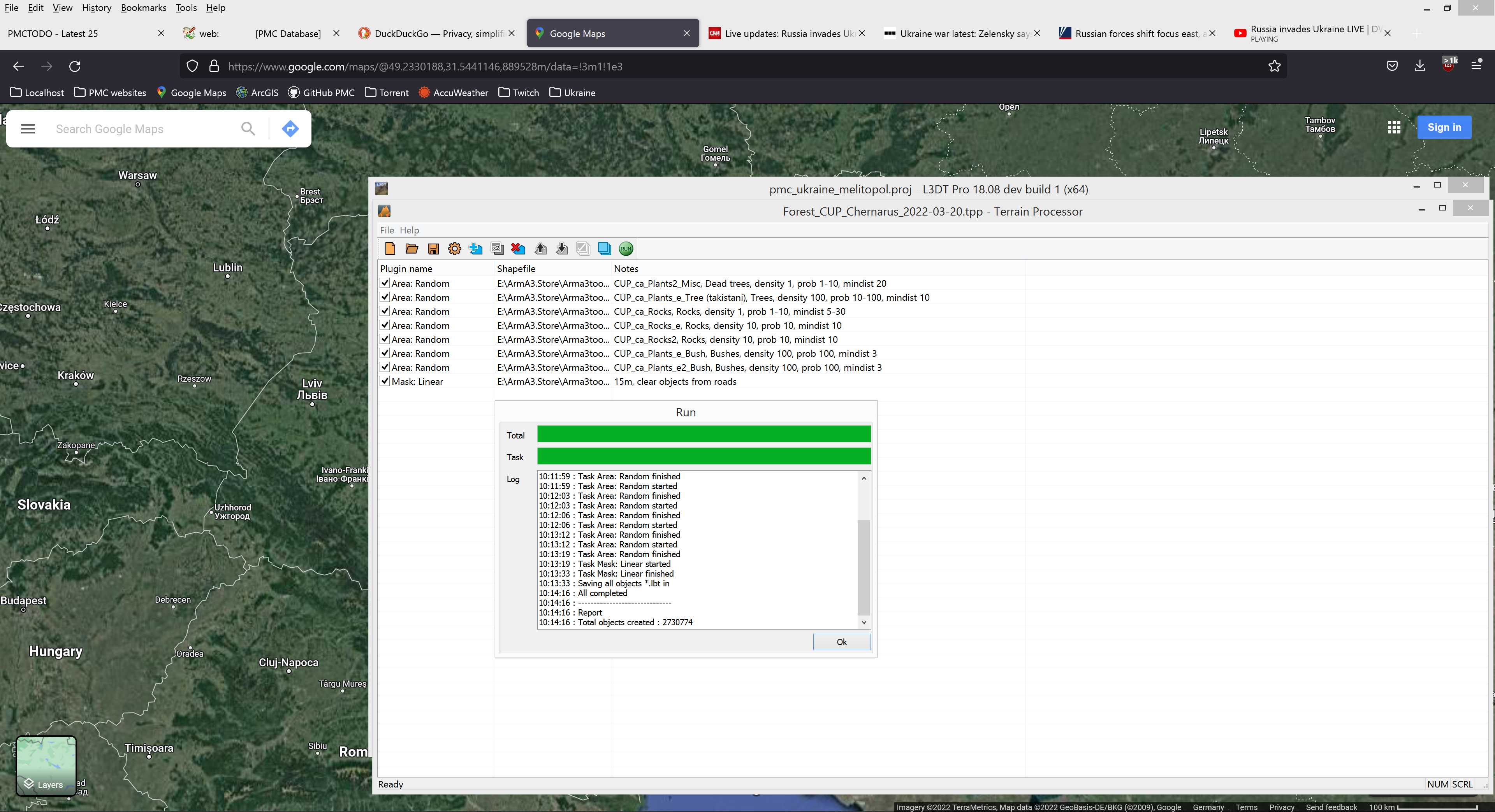
Total of 2.730 million objects. Not too bad, lightweight object setup.
Was looking around in L3DT and ... its a no go, I have NO FUCKING IDEA where the 0m elevation parts should have been, but then again they are fixed in PMC Heightmap Clipper. This is still so useless to try to fix coastline in L3DT. You simply cannot see "what is where", so I'm going to terrain builder import the clipped heightmap and it is what it is, before I manage to come up better tool pipeline for coastlines.
Terrain builder vegetation object import started, medium duration waiting time.
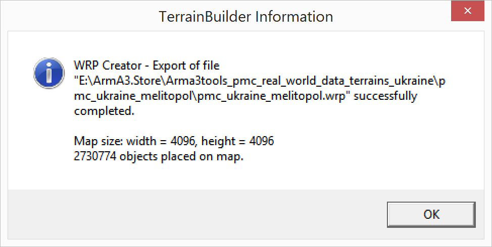
Import finished, then export WRP (CTRL-E) and it came down to:
Saved project and exited terrain builder. Then moveObject re-pathed WRP.
Next was GIMP opening all XCF satellite texture tiles from Satellite.Texture/ dir and exporting them to equivalent sat_??.png images, I started this before googling if graphicsmagick could convert XCF automatically to PNG, it would save a lot of time. While first PNG was saving (extremely long time) I googled and well graphicsmagick has no XCF support, ImageMagick does. So I created bat file to use imagemagick for the XCF to PNG conversion. I have never done this before to my recollection so no idea if it works, so going to convert them into TEMP directory instead of overwriting the actual and only PNGs I have. If there would be a issue(s) for whatever reason, it would mean another 3 or so hours of global mapper exporting which I'm not ready to wait, again.
Imagemagick did the job, quite slowly which was somewhat odd, but maybe its just the PNG image format which is somehow complex to convert and save, dunno.
2022-03-26T11:38:00Z Imagemagick finished its conversion job, when I was browsing through the images to see everything is OK... uh oh, everything was not OK, sat_G7.png was satellite MASK instead of texture, HRR! ![]()
Looks like I accidentally saved mask into wrong directory, oh man, now I have to fix clouds in this tile all over again.
Luckily sat_G7.png had one small cloud puff easily clone stamp tool brushed off in the northern edge, was a quick 2min job max.
2022-03-26T11:49:00Z Alright sat_G7.png done and other PNGs look fine too. Now I just need to make sure the final graphicsmagick conversion bat works on these new PNGs.
Yeah I know, paranoid mo-fucka heh, but I have no interest losing hours worth of work just because one step in the process failed.
Ran graphicsmagick darkening and L3DT texture map etc making bats... but heh, sat_G7.png was MASK, hehe. Yeah I guess it was saved once more to... right dir, except I didn't copy it over to the root dir, heh but hey at least I didn't lose any work, just need to copy it over to root dir and once again run the graphicsmagick bats ![]()
Also noticed that the single one full ocean tile was not done, need to pattern fill that as well.
2022-03-26T12:23:00Z Uuh finally the picturemap_ca.tga is done, looking all nice.
Then it was another, lets say, final, binarization time ![]()
Was getting really tired and just unmotivated again, feeling that zombi mode coming on fast.
Continue reading page 4, previous page 2 or back to Dev Diary PMC Ukraine Melitopol root page.
PMC Ukraine Melitopol: Changelog, Dev Diary, Screenshots. Back to PMC Terrain's page.