2022-03-30T08:57:00Z New editing day has started. Yesterday released first taiwan terrain PMC Taiwan Chiayi and today we get back to ukraine again, kherson is next on the line.
As usual when returning to a terrain project I'm going to re-read this dev diary to catch up on every little detail I did previously, after that its arma3 in-game check to verify all addons are working as expected.
(after reading this whole dev diary through): Wow that was a short one heh. No mentioning about objects, hmm must have forgotten to write it then as I surely did vegetation already. Anyways things have changed since I created this terrain and now I have better CUP chernarus Terrain Processor TPP Templates files setup which I'm going to use to create new objects.
But first, the arma3 in-game check.
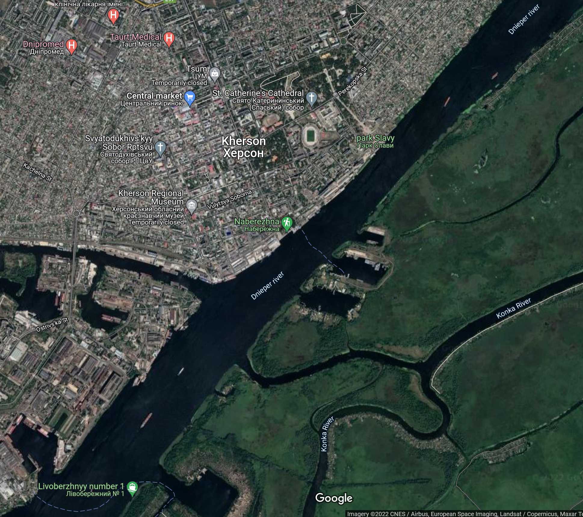
When I saw the 2D mapview I could immediately tell this is heightmap ocean coastline or dnieper river is a nightmare as a lot of the land is flooded in arma3 0m water level universe. Checked the elevations and flooded areas are all 0m, usual SRTM heightmap data.
Satellite texture has not been painted into dnieper river.
I was really baffled when I took a look in global mapper Ukraine_Kherson_40km/ directory, it had all the Roads/ and TerrainProcessor/ dirs there along with heightmap.asc, picturemap_ca.tga etc images. I don't get it, all of this should have been moved to terrain builder dir many many tool pipeline steps ago, huh what gives ![]()
Also I did paint clouds off, but just didn't paint the dnieper river ocean seabed bottom. No previous dev diary mention of it but I recall it looked so complex so decided to skip it. Well here we are, cant skip it anymore as release is getting closer.
First big thing to fix is the heightmap, I'm going to clip all the elevations 0m or below to 1m, this will remove water creeping into land flooded areas... hmm or wait, I have to create the satellite texture ocean coastline selection first.
These are the currently GIMP painted satellite texture tiles with clouds clone stamp tool brushed off:
sat_A3.xcf
sat_A4.xcf
sat_B3.xcf
sat_B4.xcf
sat_C4.xcf
sat_D1.xcf
sat_D3.xcf
2022-03-30T09:46:00Z Begin loading satellite texture tiles into GIMP, will do selections for all dnieper river ocean coastline areas now and save Sat_Mask_*.xcf images as well.
After the first river tile was done... I already felt like stressed out, this will be a bitch to do all those river ocean coastline selections. Its pain if you do the accurately meaning zoomed well in, if you do them sloppy its easier and faster, but it also looks like shit in arma3 then as well.
But I'm going to slowly, without stressing, do one tile at the time, stopping immediately if it feels like "this sucks" heh, no pressure, no hurry, one tile at the time... ![]()
2022-03-30T12:31:00Z Had to take a break, feeling that boredom burnout coming up again badly. GIMP selecting these ocean coastlines (dnieper river edges) is just a struggle right now. Doing slow progress one tile at the time, it is truly a uphill battle.
2022-03-30T13:02:00Z Oh well didn't really take break other than lunch break heh, just finished dnieper river shore lines for sat_C1.png tile.
2022-03-30T15:20:00Z Been slowly editing the dnieper river, then had an hour break as one of the PMC members called me, we had a good talk. Now back and just started graphicsmagick to process the satellite texture tile PNGs to BMPs.
Looking at the combined satellite texture image shows dnieper river very nicely painted with ocean bottom seabed texture.
Continue reading page 4, previous page 2 or back to Dev Diary PMC Ukraine Kherson root page.
PMC Ukraine Kherson: Changelog, Dev Diary, Screenshots. Back to PMC Terrain's page.