
2022-07-10T22:45:00Z This dev diary page created, terrain project has been born ![]()
2022-07-10T22:54:00Z Global Mapper project created and user created feature grid placed into correct position, I'm good to go.
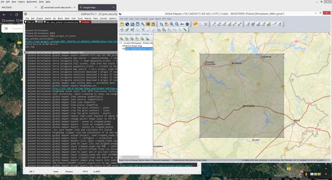
Exported Terra Incognita KMZ Rectangle and shape file of the user created feature grid. Loaded it up to overlap_poland.gmw and verified that there is no overlap (no overlap in overlap? huh!), there was not, looking good.
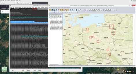
Then started Terra Incognita with cache deleting bat file, loaded KMZ up and zoomed into it, created rectangle selection around it and copy-pasted the Latitude / longitude config coordinates.
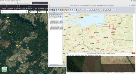
2022-07-10T23:03:00Z Started terra incognita ArcGIS 17 level satellite imagery download.
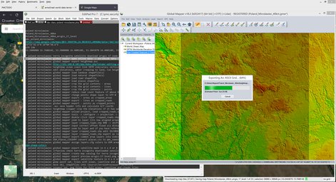
Then exported SRTM v3 ASCII Grid heightmap.asc file.
Next loaded OpenStreetMap (OSM) shape files, luckily found the right ones as poland has them split into several regions.
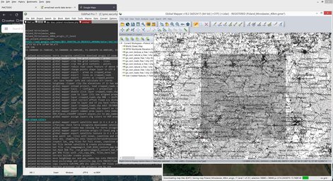
Road count was very low, like 7000, but I still reduced it by deleting cycle*, foot*, path and hmm was there something else which was pretty useless for arma3 roads.shp data. Road features count now 6292. This was done using Remove Bad OSM Roads.
Then exported cropped _areas, _lines and _points shape files. Next calculated new heightmap.asc header coordinates and edited them to Terrain Builder with UTM Projection UTM 31N compatible format.
Then transformed cropped_roads.shp into terrain builder compatible format, assigned ID/ORDER to them and exported out as roads.shp file.
Loaded cropped_areas.shp, filtered out all but FCLASS "forest", then transformed it to terrain builder compatible format and exported out as 4 x 4 grid tile setup under "Forest" name, so it came out as "Forest_A1.shp", "Forest_A2.shp" etc.
And finally did the same shuffle for cropped_points.shp, exported as CSV file, then loaded into PMC OSM Places CSV2HPP Converter tool and copy-pasted results to pmc_names.hpp config.cpp include file.
Next assigned RGB colors to OSM area shapes. Peeerrddy colors.
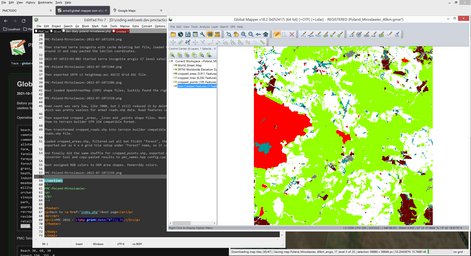
2022-07-10T23:42:00Z Started to export Sat_Mask from those OSM areas.
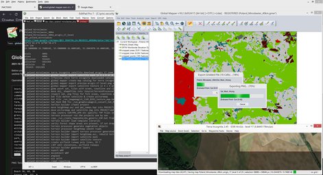
Converted the Sat_Mask_*.PNGs to BMP with some RGB fixes using GraphicsMagick bat file.
2022-07-11T00:44:00Z Created terrain builder project, moved heightmap.asc and roads/ and terrainprocessor/ Terrain Processor dirs into that project dir. Copied pmc_names.hpp over pmc_poland_miroslawiec_cfg/ addon dir.
Copied Terrain Processor TPP Templates and associated files to its dir, copied roads.* files there too. Ran all the 16 forest generation TPPs. Cant run Smooth_Roads.tpp yet because L3DT has not leveled the airfield runways.
Then created proper latitude/longitude setup for config.cpp file.
2022-07-11T01:06:00Z Started terrain builder import satellite mask tiles.
2022-07-11T01:08:00Z Done, heh, it doesn't take long with small 40km terrain ![]()
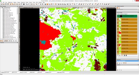
Alright now I'm looking at tool pipeline and everything has been done up to this point, there is nothing I can do right now until terra incognita finishes downloading satellite imagery. Its currently at 8 of 25 so still several hours to go... hmm, what do I do in the mean time...
2022-07-11T07:30:00Z Terra incognita had finished downloading satellite imagery.
2022-07-11T07:52:00Z Global mapper finished exporting satellite texture in 4 x 4 grid tile images.
Then in GIMP loaded these new sat_*.PNG satellite texture image tiles for inspection which might need clouds clone brushed off. I already checked with irFanview on the raw terra incognita source and I didn't see any clouds that need to be fixed, but there was some lingering smoke, so will have to go through this check anyways.
There was a lot of lakes, bodies of water, in this terrain. These are bad because arma3 doesn't do water other than 0 meter elevation, see Ocean Satellite Texture.
Checked all sat_*.PNG images, no clouds to fix, I'm are good to go for Darken Merge Picturemap Satellite Texture Tiles. This time I'm using the desert brightness version bat file.
2022-07-11T08:02:00Z Started terrain builder import satellite texture grid tiles.
Imported heightmap.asc into L3DT with L3DT_texture_map.png and smoothed the airfield runways, then exported heightmap ASCII Grid ASC file back out again.
Terrain builder created poly line for airfield runways.
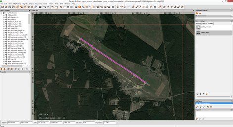
Then terrain builder exported airfield_runways.shp into root\data\roads\ dir, used global mapper to import it and added ID/ORDER properties to the poly line. Then merged it with roads.shp and exported roads.shp back out again.
Then terrain builder started to generate layers, this is another close to 40min process, now I'll wait.
Looking good though, nothing much to do than to push this data through the last few steps before its in arma3. While terrain builder was doing them layers I edited WRP and Data split bat files (Separate Data Layers for smaller PBOs), they are now good to go once I'll get there.
2022-07-11T08:52:00Z Terrain builder finished generating layers, then started to import objects.
Now objects... these judging by naked eye so to speak, might be a lot. There was 16 terrain processor project files which generated objects and each of them were several hundred thousand, often way over half a million close to one million objects. This will still work, but I would not be surprised if seeing more than 10 million objects in this terrain.
2022-07-11T09:26:00Z Started Convert Layers PNG to PAA Fast bat.
2022-07-11T09:31:00Z Finished converting puny 40k x 40k res layer PNGs ![]()
Then ran WRP and Data split bat and layers RVMAT re-pathing bat files. This was a bit scary as terrain builder is running and importing objects, but these bat files do not touch any "internal" terrain builder files so they are safe to run even with terrain builder up.
Next moved root\data\ dir contents including \roads\ into pmc_poland_miroslawiec_data\ addon dir.
2022-07-11T09:39:00Z Layer RVMAT re-pathing done using moveObject, now I have nothing else to do other than to wait until object import finishes. This will take a while as B3 have now imported, still two full rows to go.
2022-07-11T11:04:00Z Terrain builder object import finished, uah.
Then export WRP and moveObject WRP re-pathing of RVMATs. Export WRP dialog said 9,566,255 objects saved, darn I was off by half a million ![]()
2022-07-11T11:06:00Z Started pboProject to binarization (PMC Editing Wiki: search "binarize"), yeah buddy, I'm just binarization away from arma3 test.
*** pmc poland_miroslawiec
Start time: 2022-07-11T1106
pboproject pmc_poland_miroslawiec_data_layers_04
pboproject pmc_poland_miroslawiec_data_layers_03
pboproject pmc_poland_miroslawiec_data_layers_02
pboproject pmc_poland_miroslawiec_data_layers_01
pboproject pmc_poland_miroslawiec_data_layers_00
pboproject pmc_poland_miroslawiec_data_layers
pboproject pmc_poland_miroslawiec_data
pboproject pmc_poland_miroslawiec_cfg
pboproject pmc_poland_miroslawiec
End time: 2022-07-11T1120
I'm done here ![]()
Continue reading page 2 or back to Dev Diary PMC Poland Miroslawiec root page.
PMC Poland Miroslawiec: Changelog, Dev Diary, Screenshots. Back to PMC Terrain's page.