PMC Ohio Westhope 8km Development
Posted: 2023-02-24 16:17:24
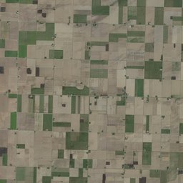
PMC Ohio Westhope 8km is 8.1 kilometer x 8.1 kilometer american real world data terrain for Farming Simulator 19 (FS19).
US NAIP satellite imagery.
Dev Diary PMC Ohio Westhope 8km.
Last night opened PMC Ohio Westhope 8km in global mapper, exported KMZ file and then terra incognita downloaded new ArcGIS world imagery satellite source. The old 2019 download was fine, pretty good actually, this new 2023 was... well different, it looked more dry, maybe it was taken at just about harvest time when there was just endless golden brown ready to harvest crops on the fields. Otherwise the satellite imagery was pretty much the same, did not spot any new farm yards or anything else changed place.
tags: farming simulator, fs19, modding, mapping (haha), american farming, american maps, mod map, big map, american dem map, ohio map.